Le 16/10/2024 par kdeschin :
Bonjour,
Nous proposons un stage de Master 2 à l'institut FEMTO-ST dans l'équipe AND (à Belfort) du département d'Informatique des Systèmes Complexes (DISC) pour une durée de 4 à 6 mois (dates et durée à convenir avec le (la) candidat(e)) à compter de janvier 2025. Nous avons une bourse de thèse disponible au candidat qui souhaiterait poursuivre ses travaux de recherche sur ce sujet.
Sujet : Collecte de données optimisée aux moyens de drone et de capteurs
Description : voir à la fin du message
Encadrants : Karine Deschinkel, Jean-Claude Charr, Mourad Hakem
Pour candidater merci de nous envoyer :
- un CV détaillé
- les relevés de notes de Master 1
Pour candidater ou obtenir plus de renseignements merci de contacter :
karine.deschinkel@univ-fcomte.fr, jean-claude.charr@univ-fcomte.fr,mourad.hakem@univ-fcomte.fr
*********************************************************************************************************
Hello,
We are offering a Master’s level internship (Master 2) at the FEMTO-ST Institute in the AND team (Belfort) of the Department of Computer Science for Complex Systems (DISC). The internship will last between 4 to 6 months (duration and starting date to be agreed upon with the selected candidate) starting in 2025. We would like to inform you that we have a PhD scholarship available for candidates who wish to continue their research work on this subject.
Topic: Optimized Data Collection Using Drones and Sensors
Description: See at the end of the message
Supervisors: Karine Deschinkel, Jean-Claude Charr, Mourad Hakem
To apply, please send us:
- A detailed CV
- Your Master 1 academic transcripts
For applications or further information, please contact:
karine.deschinkel@univ-fcomte.fr, jean-claude.charr@univ-fcomte.fr,mourad.hakem@univ-fcomte.fr
*********************************************************************************************************************
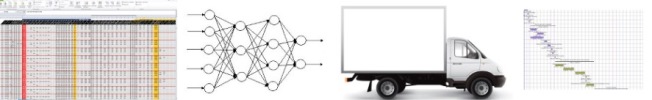
Wireless sensor networks (WSN) and robotics are revolutionizing the agriculture industry. On one side, WSNprovide valuable information about the environment (such as temperature, soil conditions, crop images, etc.).On the other, robots take actions based on this information (such as irrigation, pesticide spraying, etc.). Data collection techniques for agriculture still need to be improved. In this project, the use of a wireless undergroundsensor network (WUSN) is considered in order not to interfere with the work of agricultural machinery. The data collection will be done by an Unmanned Aerial Vehicule (UAV), or simply called drone. The problems posed by this type of system are twofold: the optimization of the flight plans of the drones to ensure theirdouble task of acquiring aerial images and communicating with the buried sensors, and the optimization of the structure of the sensor network, taking into account all the constraints. The goal is to optimise the system,especially its energy consumption. The UAV must sequentially enter the communication areas of the sensors togather their data. Hovering over each node (sensor) is not a necessity because the UAV can communicate withthe sensors while flying. To address this challenge, the Close Enough Traveling Salesman Problem (CESTP) must be adapted to this optimization problem. There are several studies addressing the CESTP byusing classical metaheuristics (genetic algorithm, ant colony optimization, etc.). A preliminary work, developed a first evolutionary algorithm with geometrical heuristics for solving the 2D close enoughTSP problem which represented the trajectory planning of the UAV. In this project, we intent to develop newapproaches based on recent heuristics in optimization and also machine learning techniques.The work will be broken down into two stages:
•The first stage will consist in understanding the optimization problems, objectives and constraints linkedto the specific use of WUSNs and UAVs technologies in the area of environmental monitoring. For this reason, the student will carry out a bibliographical study.
•During the second stage, he has to propose models and resolution methods to best determine the network infrastructure (sensor placement and UAV flight plans ) to increase the network lifetime while maximizingthe information collection